![](/images/other/stat-length.png)
![Randonnée V.T.T. Mont Lozère et Goulet - Chasserades Finiels 2020 - Photo](https://media.geolcdn.com/t/1900/400/ext.pjpeg?maxdim=2&url=https%3A%2F%2Fmedia.geolcdn.com%2Ff%2F6b5f0140-2a52-469f-ac07-12640915fb18.jpg)
Chasserades Finiels 2020
JeanPierreNancy
Utilisateur
![Longueur](/images/other/stat-length.png)
Longueur
48 km
![Altitude max](https://static1.geolcdn.com/siteimages/upload/files/1508320355ic_sort_altitude_max_24dp.png)
Altitude max
1672 m
![Dénivelé positif](https://static1.geolcdn.com/siteimages/upload/files/1508320355ic_sort_den_pos_24dp.png)
Dénivelé positif
1417 m
![Km-Effort](/images/other/stat-length.png)
Km-Effort
67 km
![Altitude min](https://static1.geolcdn.com/siteimages/upload/files/1508320355ic_sort_altitude_min_24dp.png)
Altitude min
1063 m
![Dénivelé négatif](https://static1.geolcdn.com/siteimages/upload/files/1508320355ic_sort_den_neg_24dp.png)
Dénivelé négatif
1364 m
![Boucle](https://static1.geolcdn.com/siteimages/upload/files/16400158638029165_repeat_loop_refresh_sync_direction_icon.png)
Boucle
Non
Date de création :
2020-07-31 06:45:22.927
Dernière modification :
2020-08-09 07:00:48.38
![V.T.T.](https://static1.geolcdn.com/sitytour/trail-icons/202.png)
5h36
Difficulté : Difficile
![Scannez ce code QR pour ouvrir la randonnée dans l'application SityTrail](https://capi.geolives.com/qq0zvz2zws4bq2lad0pu/sitytour/trails/2497383/qr.png?size=200)
Application GPS de randonnée GRATUITE
À propos
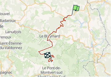
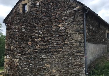
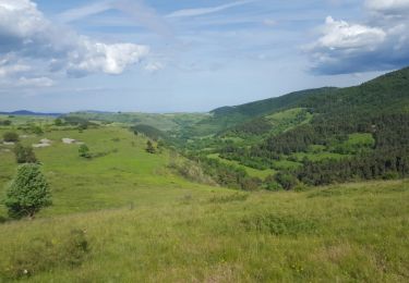
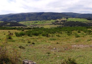
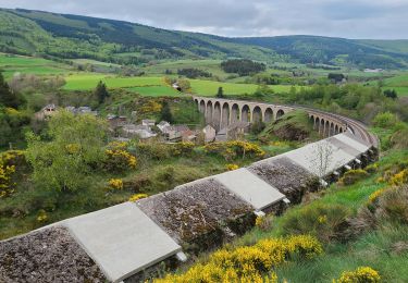
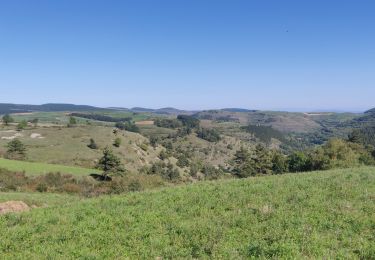
Randonnée V.T.T. de 48 km à découvrir à Occitanie, Lozère, Mont Lozère et Goulet. Cette randonnée est proposée par JeanPierreNancy.
Description
Attention : Pb GPS après la station du Bleymard, on peut faire le tour en passant par le chemin des Chômeurs, ce qui offre de beaux paysages, compter 10 km en plus)
Localisation
Pays :
France
Région :
Occitanie
Département/Province :
Lozère
Commune :
Mont Lozère et Goulet
Localité :
Unknown
Départ:(Dec)
Départ:(UTM)
566437 ; 4933660 (31T) N.
Commentaires
Randonnées à proximité
![Randonnée Marche Mont Lozère et Goulet - Stevenson étape 7 - Photo](https://media.geolcdn.com/t/375/260/ext.jpg?maxdim=2&url=https%3A%2F%2Fmedia.geolcdn.com%2Ff%2Fca5e79f2-b988-472d-b1a4-865ced3314e1.jpg)
![Marche Marche](https://static1.geolcdn.com/sitytour/trail-icons/101.png)
Stevenson étape 7
Marche
Difficile
Mont Lozère et Goulet,
Occitanie,
Lozère,
France
![](/images/other/stat-length.png)
20 km | 28 km-effort
4h 57min
![](https://static1.geolcdn.com/siteimages/upload/files/16400158638029165_repeat_loop_refresh_sync_direction_icon.png)
Non
![Randonnée Marche Mont Lozère et Goulet - le Bleymard - Photo](https://media.geolcdn.com/t/375/260/ext.jpg?maxdim=2&url=https%3A%2F%2Fmedia.geolcdn.com%2Ff%2Fa7e52d95-c918-4024-aa49-8bd4f60cbf65.jpg)
![Marche Marche](https://static1.geolcdn.com/sitytour/trail-icons/101.png)
le Bleymard
Marche
Très difficile
Mont Lozère et Goulet,
Occitanie,
Lozère,
France
![](/images/other/stat-length.png)
17,3 km | 25 km-effort
5h 14min
![](https://static1.geolcdn.com/siteimages/upload/files/16400158638029165_repeat_loop_refresh_sync_direction_icon.png)
Non
![Randonnée Marche Mont Lozère et Goulet - Chasserades Bleymard - Photo](https://media.geolcdn.com/t/375/260/ext.jpg?maxdim=2&url=https%3A%2F%2Fmedia.geolcdn.com%2Ff%2F116a16c1-813e-45da-b910-05ff52927fe4.jpg)
![Marche Marche](https://static1.geolcdn.com/sitytour/trail-icons/101.png)
Chasserades Bleymard
Marche
Difficile
Mont Lozère et Goulet,
Occitanie,
Lozère,
France
![](/images/other/stat-length.png)
20 km | 28 km-effort
6h 57min
![](https://static1.geolcdn.com/siteimages/upload/files/16400158638029165_repeat_loop_refresh_sync_direction_icon.png)
Non
![Randonnée Marche Mont Lozère et Goulet - arsel chasserades au bleymard - Photo](https://media.geolcdn.com/t/375/260/ext.jpg?maxdim=2&url=https%3A%2F%2Fmedia.geolcdn.com%2Ff%2F93179cba-083a-4533-8ddb-80481acfe8eb.jpg)
![Marche Marche](https://static1.geolcdn.com/sitytour/trail-icons/101.png)
arsel chasserades au bleymard
Marche
Très facile
Mont Lozère et Goulet,
Occitanie,
Lozère,
France
![](/images/other/stat-length.png)
14,1 km | 21 km-effort
6h 14min
![](https://static1.geolcdn.com/siteimages/upload/files/16400158638029165_repeat_loop_refresh_sync_direction_icon.png)
Non
![Randonnée Marche Mont Lozère et Goulet - Chasserades -Station Mont Lozère Stevenson - Photo](https://media.geolcdn.com/t/375/260/ext.jpg?maxdim=2&url=https%3A%2F%2Fservices.sitytrail.com%2FGeolivesWS%2FDownloadMedia.ashx%3FTrailID%3D769906%26Media%3Dfix__20170609174625.jpg)
![Marche Marche](https://static1.geolcdn.com/sitytour/trail-icons/101.png)
Chasserades -Station Mont Lozère Stevenson
Marche
Difficile
(1)
Mont Lozère et Goulet,
Occitanie,
Lozère,
France
![](/images/other/stat-length.png)
25 km | 37 km-effort
7h 47min
![](https://static1.geolcdn.com/siteimages/upload/files/16400158638029165_repeat_loop_refresh_sync_direction_icon.png)
Non
![Randonnée Marche Mont Lozère et Goulet - GR_70_AG_07_Mont-Lozere-Goulet_Cubieres_20140921 - Photo](https://media.geolcdn.com/t/375/260/ext.jpg?maxdim=2&url=https%3A%2F%2Fmedia.geolcdn.com%2Ff%2F92dee3e4-41e7-4ad0-84cd-5991c85db334.JPG)
![Marche Marche](https://static1.geolcdn.com/sitytour/trail-icons/101.png)
GR_70_AG_07_Mont-Lozere-Goulet_Cubieres_20140921
Marche
Très difficile
Mont Lozère et Goulet,
Occitanie,
Lozère,
France
![](/images/other/stat-length.png)
19,8 km | 30 km-effort
6h 12min
![](https://static1.geolcdn.com/siteimages/upload/files/16400158638029165_repeat_loop_refresh_sync_direction_icon.png)
Non
![Randonnée Marche Mont Lozère et Goulet - Stevenson Chasseradès - Le Bleymard - Photo](https://media.geolcdn.com/t/375/260/ext.jpg?maxdim=2&url=https%3A%2F%2Fmedia.geolcdn.com%2Ff%2F084f4a90-f605-49e0-8cc1-95e8aee0296f.jpg)
![Marche Marche](https://static1.geolcdn.com/sitytour/trail-icons/101.png)
Stevenson Chasseradès - Le Bleymard
Marche
Très difficile
Mont Lozère et Goulet,
Occitanie,
Lozère,
France
![](/images/other/stat-length.png)
21 km | 29 km-effort
5h 4min
![](https://static1.geolcdn.com/siteimages/upload/files/16400158638029165_repeat_loop_refresh_sync_direction_icon.png)
Non
![Randonnée Marche Mont Lozère et Goulet - 20230405 Chasserades-le Bleymard - Photo](https://media.geolcdn.com/t/375/260/ext.jpg?maxdim=2&url=https%3A%2F%2Fmedia.geolcdn.com%2Ff%2Fb832b3bb-1b81-4f6a-812b-f75e16b8837f.jpg)
![Marche Marche](https://static1.geolcdn.com/sitytour/trail-icons/101.png)
20230405 Chasserades-le Bleymard
Marche
Facile
Mont Lozère et Goulet,
Occitanie,
Lozère,
France
![](/images/other/stat-length.png)
18,7 km | 26 km-effort
4h 32min
![](https://static1.geolcdn.com/siteimages/upload/files/16400158638029165_repeat_loop_refresh_sync_direction_icon.png)
Non
![Randonnée Randonnée équestre Mont Lozère et Goulet - 2022-09-19 Rando CVA Lozere Chasserades vers Refuge Mont Lozere - Photo](https://media.geolcdn.com/t/375/260/ext.jpg?maxdim=2&url=https%3A%2F%2Fmedia.geolcdn.com%2Ff%2F6d292e5f-9605-4521-957b-13808f44d1b6.jpg)
![Randonnée équestre Randonnée équestre](https://static1.geolcdn.com/sitytour/trail-icons/301.png)
2022-09-19 Rando CVA Lozere Chasserades vers Refuge Mont Lozere
Randonnée équestre
Moyen
Mont Lozère et Goulet,
Occitanie,
Lozère,
France
![](/images/other/stat-length.png)
27 km | 40 km-effort
5h 46min
![](https://static1.geolcdn.com/siteimages/upload/files/16400158638029165_repeat_loop_refresh_sync_direction_icon.png)
Non